Tuesday, June 15, 2010


VANCOUVER

LONGITUDE: 49°15′N (1

LATIDUDE: 123°6′W (1)

POPULATION: 578,041(1)

POPULATION DENSITY: 5,335/km2 (1)

LANFORMS: western CORDILLERA (2)

CLIMATE: oceanic climate (2)

Ecozone: pacific maritime (2)

CLOSEST NATIONAL PARK: gulf island national park reserve of Canada (3)

INDUSTRIES: forestry (1)

TOURISM: Science World, Capilano Suspension Bridge, Vancouver art gallery, Vancouver public library (1)

PICTURES AND MAPS:

were at the best we had been to and its wonderful I saw the 3rd largest library in Canada; its heaven I have never seen so many books I wished lived in the library, I wanted to take out some books but I don’t have a library card; aw man! next we went to the Vancouver art gallery it is so amazing there all of Marc Chagall artists. Marc Chagall pictures are amazing we saw some more pictures but Marc Chagall was the best.

it.was.amazing. THE Capilano bridge felt like we were crossing a bridge in a remotes jungle, but fortunately we had to be careful there had been incidents in and near the bridge. it was just in June 6, 2010 that was when a high school student fell off the bridge and died. L

on our last day we spent an entire day at the science world and i loved how it was shaped as a globe and made me interact with myself and other thing with science a lot. ahhh, our trip is over and were going back to Thorold. hopefully we’ll go again but instead the world we’ll explore.

(1)Wikipedia.org

(2) Making Connections Second Edition Canada’s Geography 9 (pg 154,175,130)

(3)pc.gc.ca

Vancouver Aerial

Vancouver public library

Inside Library
Vancouver Art Gallery

Capilano Suspension bridge

Science World


YELLOWKNIFE

LONGITUDE: 62°26′32″N (1)

LATIDUDE: 114°23′51″W (1)

POPULATION: 18,700 (1)

POPULATION DENSITY: 177.7/km2 (1)

LANDFORMS: taiga SHIELD (2)

CLIMATE: Taiga (2)

Ecozone: Canadian Shield (2)

CLOSEST NATIONAL PARK: wood buffalo national park (3)

INDUSTRIES: mining, industry, transportation, communications, education, health, tourism, commerce (1)

TOURISM: Northern Arts and Cultural Centre, Prince of Wales Northern Heritage Centre (1)

PICTURES AND MAPS:

Were at Yellowknife, it is a little cold out here so I talked with my family and were going to the Prince of Whales Northern Heritage Centre, which was my idea by the way. outside of the centre was a…very interesting building I personally think it’s no cool, since some of it looks like a barn but inside; it was very cool all the cool Inuit’s and lots of old materials from other tribes.

the next day it was a tough decision to go to the Northern Arts and Cultural Centre, but yet again I got paid green to go. the stage was massive and the weird thing was it’s in a school! we watched a show and it was amazing so I had to give the green back, since I liked it; I lost money for my coin collection. next were up to Vancouver and yet again we only spent two days in Yellowknife; were going to spend 3 days in Vancouver it has lots of interesting architecture and fascinating buildings.

(1)wikipedia.org

(2) Making Connections Second Edition Canada’s Geography 9 (pg 154,175,130)

(3) pc.gc.ca

Yellowknife Aerial

Prince of Wales Northern Heritage Centre

Northern Arts and Cultural Centre


Sunday, June 13, 2010

Sudbury:

LONGITUDE: 46°29′24″N (1)

LATIDUDE: 81°00′36″W (1)

POPULATION: 157,857(1)

POPULATION DENSITY: 49.3/km2 (1)

LANFORMS: Canadian SHIELD (2)

CLIMATE: Boreal (2)

Ecozone: BOREAL shield (2)

CLOSEST NATIONAL PARK: Georgian Bay island National Park (3)

INDUSTRIES: MINING (1)

TOURISM: science north, art gallery of Sudbury (4)

PICTURES AND MAPS:

I and my family are at Sudbury and it the best city I have been at, because they coins there and IT’S perfect for my coin collection. I and my family went to check out the giant nickel and it awesome; I wish I HAVE one at my home. I wish science north also came with the package; it is awesome, it has all the science I know and even more.

the rest of my family wanted to go to the art gallery of Sudbury but I think I had enough of art, but they paid me green to go with them. the building is really old but it has some interesting pieces inside. we had to leave early because, we want to spend more time in Vancouver, I think personally that’s great it has lots of great things’ but first things first we have to go to Yellowknife.

(1)Wikipedia.org

(2) Making Connections Second Edition Canada’s Geography 9 (pg 154,175,130)

(3) pc.gc.ca

(4)http://www.artsudbury.org/

& Sciencenorth.ca


Sudbury Aerial

Nickel

Science North

Art Gallery of Sudbury


Saturday, June 12, 2010

Some Interesting Material For Montreal

Montreal:

LONGITUDE: 45°30′N (1)

LATIDUDE: 73°40′W (1)

POPULATION: 1, 620,693 (1)

POPULATION DENSITY: 4,439/km2 (1)

LANFORMS: Canadian SHIELD (2)

CLIMATE: boreal (2)

ECOZONE: mixed wood PLANES (2)

CLOSEST NATIONAL PARK: St.Lawrence island national park(3)

INDUSTRIES:commerce, aerospace, finance, pharmaceuticals, technology, culture, tourism, film and world affairs(1)

TOURISM: Mont royal, the old architecture (4)

PICTURES AND MAPS:

So were at Montreal and it’s really fascinating in downtown, because of the old buildings there are. All the buildings are even better than St.Catharines downtown; they don’t have this fascinating architecture like Montreal. So we went shop in it besides looking and some stores are old and new they made it modern for more people. While we were shopping I saw the road and it really cool; it was all bricks for some of the downtown old Montreal, I’ve only seen these roads when I was in Pakistan.

The next day we went to Mont Royal and it is huge; it was a great climb and we saw parts of Montreal. It was great I saw some species of squirrels. I didn’t see a single industries traces or workers near there so it’s great to protect the land from evil business. I want to see my aunt’s friend but I didn’t have enough time so great ready Sudbury for a bomb.

(1)Wikipedia.org

(2) Making Connections Second Edition Canada’s Geography 9 (pg 154,175,130)

(3)Pc.gc.ca

(4) Uscw.canada.travel

Montreal Aerial View


Old Montreal


Mont Royal (Mount Royal (English))


Tuesday, June 8, 2010

Halifax

This is interesting info I found about Halifax

HALIFAX:

LONGITUDE: 44°5116N (1)

LATIDUDE: 63°1157W (1)

POPULATION: 372,679(1)

POPULATION DENSITY: 67.9/km2 (1)

LANFORMS: Appalachian (2)

CLIMATE: Atlantic maritime (3)

ECOZONE: Atlantic maritime (3)

CLOSEST NATIONAL PARK: kejimkujik national park (4)

INDUSTRIES: Agriculture, fishing, mining, forestry (1)

TOURISM: Halifax citadel, pier 21(5)

PICTURES AND MAPS:

So we left from Thorold and we started our adventure to Halifax. It took us more than 20 hours to get there on car, nut it was great, since we drove in my dad’s luxurious car a Toyota sequoia; it was great. Our first stop was the Halifax Citadel site, one word; awesome! It was beautiful there, but the craziest was how it was shaped like a star.

On our next stop we went to the legendary Pier 21 it was very interesting how it was used and it was exactly like I read in my Geography class. My mom wanted to go to the Art Gallery of Nova Scotia really badly so I went with her and it was amazing, all the pictures were Fascinating. so we left I’m going to miss Halifax, I still wanted to go to the Discovery Centre but we ran out of time next city; here we come Montreal.

(1)Wikipedia.org

(2) Making Connections Second Edition Canada’s Geography 9 (pg 130)

(3) Making Connections Second Edition Canada’s Geography 9 (pg 154 & 175)

(4) Pc.gc.ca

(5) Uscw.Canada.travel

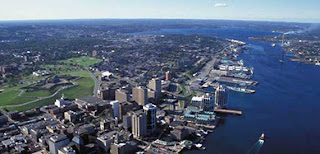
Halifax Aerial Photo

The Citadel


Pier 21 Ariel photo


Me and my family are going across Canada to 5 cities. One word; boo yah! My family and me are going to Halifax, Montreal, Sudbury, Yellowknife, and Vancouver. We wanted to go to these five cities, since they are very interesting and are capital cities and they have great tourism areas.